

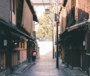
Let’s plan the city the way the weather behaves—not the other way round. A rain-first itinerary starts with the things you can enjoy in full even under a stubborn cloudbase: covered shotengai (arcades), underground passages, indoor museums and an evening sentō to finish warm. It sounds niche until you look at the numbers. Tokyo’s annual precipitation hovers around 1,500 mm, with well over 100 wet days a year; Kyoto and Osaka are in the same ballpark. That’s not a drizzle problem—it’s a design problem your day plan can solve.
In practice, a rain-first day is a string of short hops “sous abri”: station concourse → underground mall → covered arcade → museum → sentō. Distances shrink when you stay indoors, morale stays high, and you don’t spend half the afternoon drying trainers under a hand dryer. Below you’ll find three city playbooks (Tokyo, Kyoto, Osaka), each with a pair of routes, precise spots that are genuinely under cover, and small data points—distance under roof, where the rain-safe entrances are, and when queues spike. At the end, a minimal business concept shows how to productise this into a subscription.
Tokyo: stitch the underground to the arcades
Why it works: vast underground networks at Shinjuku and Shibuya link directly to malls and museums; covered arcades like Nakano Sun Mall (≈220 m) let you extend the dry zone into neighbourhoods with food, toys and second-hand culture.
Route A — Shinjuku Subnade → Museum block → sentō finish
- Start: Shinjuku Subnade (≈100 shops; underground, signed from the station concourses). Why here: easy breakfast and cash machines without stepping outside.
- Hop: underground passages to the big department-store basements for lunch tastings (depachika).
- Museum choice: Tokyo Opera City Art Gallery or Sompo Museum of Art (short indoor links via passages and covered porticoes).
- Evening: Thermae-Yū (Shinjuku) for a reliable hot-and-dry reset; late-night opening helps you dodge the heaviest showers.
Route B — Shibuya “Chikamichi” → Hikarie → Mark City
- Shibuya Chikamichi underground passage, ~370 m end-to-end, runs 109 ↔ Hikarie and keeps you out of the scramble entirely. From there you ride the complex vertically for food, exhibitions and shopping without touching the pavement.
- Add-on: jump two stops to Nakano Sun Mall (covered arcade, ≈220 m) for a retro wander under glass—ideal if the weather flips again mid-afternoon.
Tokyo metrics to watch
- Rain seasonality: the late spring/early summer tsuyu and early autumn typhoons front-load downpours; the wettest months cluster around June–September.
- Under-cover distance: Subnade blocks + Shinjuku concourses easily yield 1–2 km of walking entirely indoors; add department-store overbridges for more.
- Stations with sheltered access: Shinjuku, Shibuya (Chikamichi, Hikarie concourses).
Kyoto: arcades first, culture second, bath last
Why it works: Downtown Kyoto has twin covered arteries—Teramachi and Shinkyōgoku—plus Nishiki Market, and the Kyoto Station/Porta underground complex. On a soggy day you can traverse most of central Kyoto sous abri with strategic subway hops.
Route C — Kyoto Station City & Porta → Manga Museum → arcades
- Start: Kyoto Station City → Porta (220+ shops): breakfast indoors, then surface via covered canopies only where needed.
- Hop: Karasuma Line to Karasuma Oike; head to the Kyoto International Manga Museum (indoors; family-friendly).
- Stretch: walk south into Teramachi/Shinkyōgoku arcades (500 m+ combined; fully covered) to graze snacks and buy umbrellas that won’t invert.
Route D — Arcades loop → museum → historic sentō
- Start: Shinkyōgoku → Teramachi → Nishiki (mostly under roof).
- Museum choice: Kyoto National Museum (indoors; bring a compact brolly for the short exterior segments).
- Evening: Funaoka Onsen—a classic sentō with multiple baths and a small outdoor tub; open till late (~01:00).
Kyoto metrics to watch
- Annual precipitation: ~1,500–1,700 mm; June is often the wettest month, winter the driest.
- Under-cover distance: Porta + station concourses deliver >1 km indoors; Teramachi/Shinkyōgoku add ~0.5 kmmore in one go.
- Stations with sheltered access: Kyoto (Porta), Shijō/Karasuma (underground links into the arcades).
Osaka: underground cities with a shotengai superpower
Why it works: Osaka’s underground is practically a second city: Whity Umeda around Osaka/Umeda, Namba Walkrunning ~715 m east-west, and long, covered shotengai including Tenjinbashisuji—Japan’s longest, at ~2.6 km. You can stay dry for hours and still feel you’ve seen the city.
Route E — Umeda underground → Nakanoshima museum double → sentō
- Start: Whity Umeda for coffee and errands under the junction of multiple lines.
- Museums: hop to Nakanoshima for the National Museum of Art, Osaka (mostly underground building) and neighbouring Science Museum—a perfect rainy-day pair.
- Evening: subway to Tenjinbashisuji 6-chōme for Naniwa-no-Yu (rooftop hot spring, long hours), then exit into the covered Tenjinbashisuji arcade for snacks under the roof on the way back.
Route F — Namba Walk spine → Kuromon Market → aquarium plan B
- Start: Namba Walk (~715 m) lets you move station-to-station in the dry; surface just for Kuromon Ichiba (partly covered) and back underground when the sky opens again.
- Family add-on: if the rain turns biblical, Kaiyukan (aquarium) is largely indoors; time your entry mid-afternoon to dodge prams.
Osaka metrics to watch
- Annual precipitation: ~1,300–1,500 mm; June is typically the wettest month.
- Under-cover distance: Tenjinbashisuji alone gives 2.6 km of covered walking; Namba Walk adds ~0.7 km on one axis; add mezzanines and you’ll easily clock 5–7 km dry in a day.
- Stations with sheltered access: Umeda/Osaka (Whity), Namba (Walk), Tenjinbashisuji 6-chōme (short walk to Naniwa-no-Yu).
Data corner: rain patterns, waiting windows, “distance à couvert”
A few numbers make route choices crisper:
- Wet days per year (approx.): Tokyo ~117, Kyoto ~115, Osaka ~108—enough to warrant a proper “rain mode” in your planning app.
- Monthly peaks: early summer (June) spikes across the three cities; Tokyo often sees a second peak around September with typhoon systems.
- Covered arcs at a glance: Nakano Sun Mall (~220 m); Teramachi/Shinkyōgoku (~500 m+ combined); Tenjinbashisuji (~2.6 km); Namba Walk (~715 m). These lengths are literal dry strides you can bank in any forecast.
Operationally, queue times inflate on rainy weekends where families crowd the same indoor magnets (science museums, aquariums). The simplest fix is a reversed day—late morning in arcades, museums after 15:00, bathhouse post-dinner—which shifts you out of the stroller wave and onto emptier concourses.
Mid-article design note: how to make your maps travel
If you’re sharing these routes to a family chat or a client Slack, design the itinerary to survive screenshots and platform compression:
- Export your route card with high-contrast labels and merge photos of the key waypoints (station → arcade → museum) into a single square asset; most feeds prefer 1:1 anyway.
- On carousel posts, merge photos so that frame 1 and the last frame both carry the timings and the rain icon—people often forward only one slide.
- For a bilingual audience (FR/EN), merge photos of pictograms (umbrella, escalator, café) with short text fragments to avoid line-break chaos; tools like Adobe Express make template maintenance painless.
Three plug-and-play circuits (with “sous abri” scores)
Tokyo — “All-indoors Shinjuku” (~2.5 km under cover)
- Subnade breakfast → department-store basements → Sompo Museum → Subnade coffee → Thermae-Yū.
- Sous abri score: ★★★★☆ (brief surface hops if you choose a museum outside the immediate grid).
Kyoto — “Arcades & manga” (~1.8 km under cover)
- Kyoto Station/Porta → Karasuma Oike (subway) → Manga Museum → Teramachi/Shinkyōgoku → Nishiki Market.
- Sous abri score: ★★★★☆ (short uncovered streets between subway exits and museums).
Osaka — “Umeda to Tenjinbashi + hot spring” (~3.5 km under cover)
- Whity Umeda → National Museum of Art (via underground corridors/short canopies) → subway to Tenjinbashisuji 6-chōme → Tenjinbashisuji stroll → Naniwa-no-Yu.
- Sous abri score: ★★★★★ (almost all indoor/covered; brief street crossing to the bath).
Etiquette & micro-logistics (so the day stays smooth)
- Sentō basics: bring or rent a small towel; wash before you soak; tattoos are increasingly tolerated but still check house rules (Kyoto’s Funaoka Onsen is historically welcoming).
- Umbrellas: compact 65–75 cm canopies are the sweet spot for arcades; shelters tend to be lower than high-street awnings.
- Shoes: prioritise grip over waterproofing; covered arcades can be slick at the thresholds.
- Wayfinding: in Umeda and Shinjuku, GPS drifts underground; rely on colour-coded exits and pictograms, not blue dots.
The MVP business: “Rain Plan” as a subscription
There’s a small, neat product hiding in plain sight. Call it Rain Plan—a monthly pass that delivers six pre-built rain-first circuits per city, refreshed seasonally and timed to real museum calendars and station works. The proposition is happier days out with lower friction per decision.
What members get
- 6 ready-to-go circuits (2 per city) with offline maps, sous abri distances and exit-by-exit instructions.
- Check-lists (cashless pitfalls, towel/coin laundry, coin-locker sizes at your start/end).
- Peak-avoidance alerts (rain radar + “go now” windows for aquariums/science centres).
- Deals stack: affiliate eSIM for weather alerts without roaming shocks; compact umbrella partners; small discounts at bathhouses and café chains near the routes.
How it makes money
- B2C: ¥500–¥700/month introductory price; aim for 20–30% attach on city-break travellers who have already purchased rail passes or eSIMs.
- B2B: white-label for hotels/hostels; sell “rain day rescue” bundles at check-in.
- Affiliate: meaningful conversion on eSIM and umbrellas; soft-bundle with late-checkout offers on downpour weekends.
Key metrics to track
- Completion rate of circuits (from route start beacon to last POI).
- NPS on “stayed dry / stayed happy”.
- Refund driver analysis (if any): most likely mis-wayfinding at complex nodes like Umeda; fix with better exit cards.
- Churn after first rain-free month—counter with sun-first variants that reuse the same stops.
Recommendations
- Start with the longest roofs. Make Tenjinbashisuji (2.6 km), Namba Walk (715 m), Nakano Sun Mall (220 m)and Teramachi/Shinkyōgoku (500 m+) your backbone segments; you’re then choosing where to surface, not whether.
- Use stations as rain locks. Shinjuku, Shibuya, Kyoto and Umeda/Namba are essentially indoor cities; learn two exits per node (one primary, one fallback) and you’ll stay dry.
- Plan the warm finish. A 60–90-minute sentō (Shinjuku Thermae-Yū, Kyoto Funaoka, Osaka Naniwa-no-Yu) resets mood and feet; it’s the most effective hedge against grey skies that drag.
- Design your map like a social asset. For sharing, merge photos of your three key waypoints into a single square with timings; repeat the merge photos idea on the first and last slides of any carousel; when translating for friends, merge photos with icons to avoid text overflow.
- Keep the data small but decisive. One wet-days stat, one under-cover distance stat, and one station-exit note per route beat a paragraph of weather prose when you’re printing this for a hotel lobby.
With a little forethought—and a willingness to treat roofs, tunnels and arcades as features, not compromises—you’ll discover that Japan’s great cities are better in the rain. On a day when umbrellas bloom and pavements glaze, the warmth of a museum café, the glow of a lanterned arcade and the steam of a neighbourhood bathhouse are not second choices. They are exactly the point of being there.